 FEAMP GeoNetwork catalogue
Stazione Zoologica Anton Dohrn
Type of resources
Topics
INSPIRE themes
Keywords
Contact for the resource
Provided by
Years
Formats
Representation types
Update frequencies
status
Resolution
-
Dataset MSFD - Coralligenous habitat, Maerl, Pinna nobilis
-
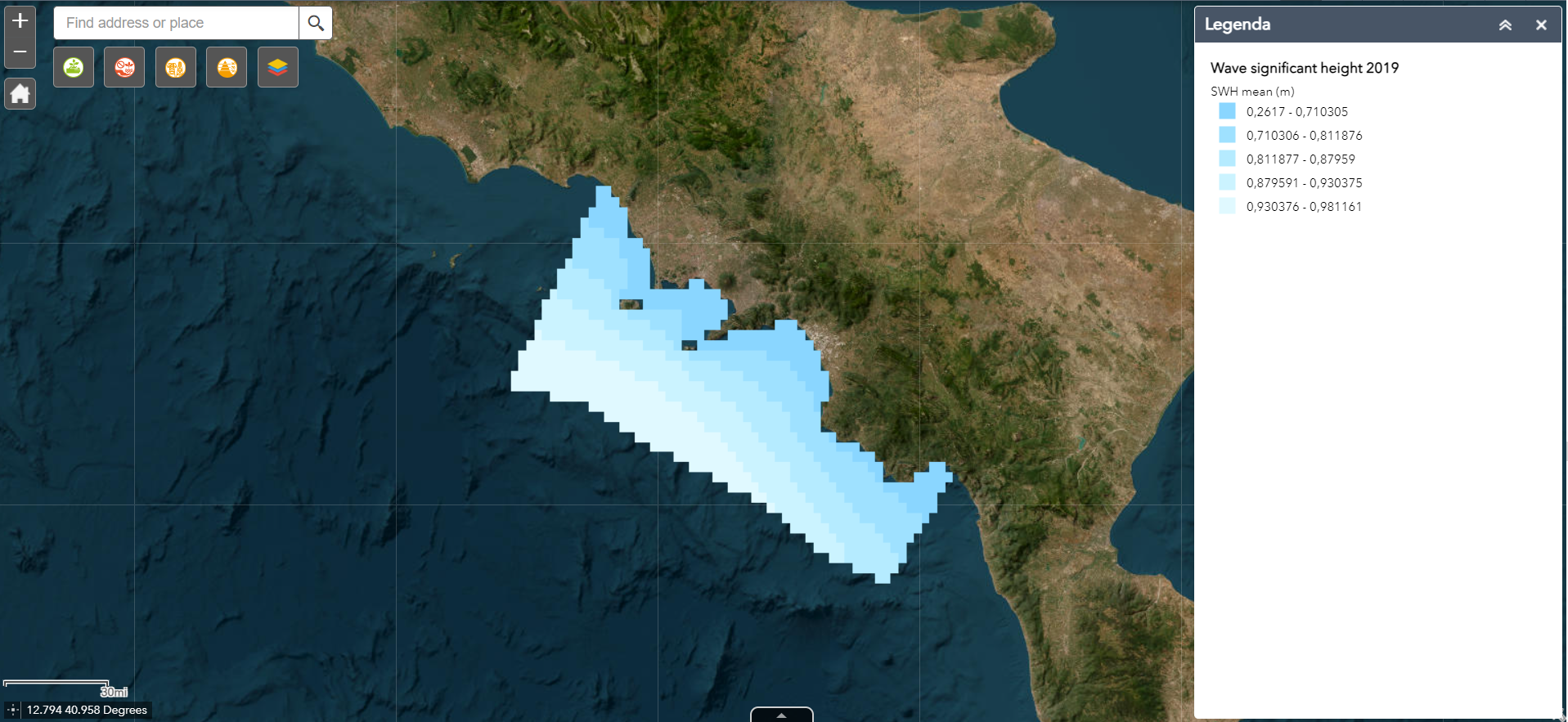
The wave significant height (VHM0) map package was built with daily-mean data remotely collected. The package contains mean, max, min VHM0 maps at low resolution (~5km) collected during 2019. The maps were also built over the four quarters of the year. These layers are provided with the suffixes Q1 to Q4.
-
Records of marine benthic species protected by the Directive Habitat in Campania
-

The data concern the presence of pathogens in samples of coastal surface waters collected along the Domitio coast - Gulf of Gaeta, the Gulf of Naples and the Gulf of Salerno, during two sampling campaigns carried out between 2020 and 2021. In particular, it was analysed the presence of total coliforms, enterococci, and pathogens belonging to the genera Staphylococcus, Salmonella and Shighella. The results are expressed in CFU/100 ml.
-

Campania UNESCO World Heritage Sites downloaded from the websites of the Ministery of Cultural Heritage.
-

The superficial sea temperature (SST) map package was built with daily-mean data at high spatial resolution (0.01 degree) remotely collected between 2008 and 2020. The maps were also built over the four quarters of the time period. These layers are provided with the suffixes Q1 to Q4. The SST trend maps show the increasing or decreasing trend of SST over the selected time period.
-
Pictures of photo quadrats at three different depth of selected sampling sites within MPA Castellabate
-
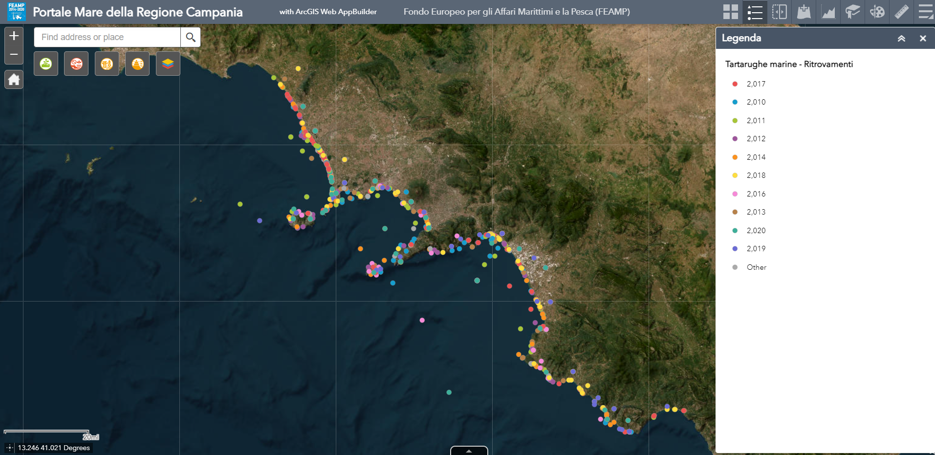
Map showing the distribution of marine turtle strandings (dead and alive) in the Campania Region between 2010 and 2020.
-

Continental shelf corresponding to 200 meters below sea level generated from the EMODnet DTM
-
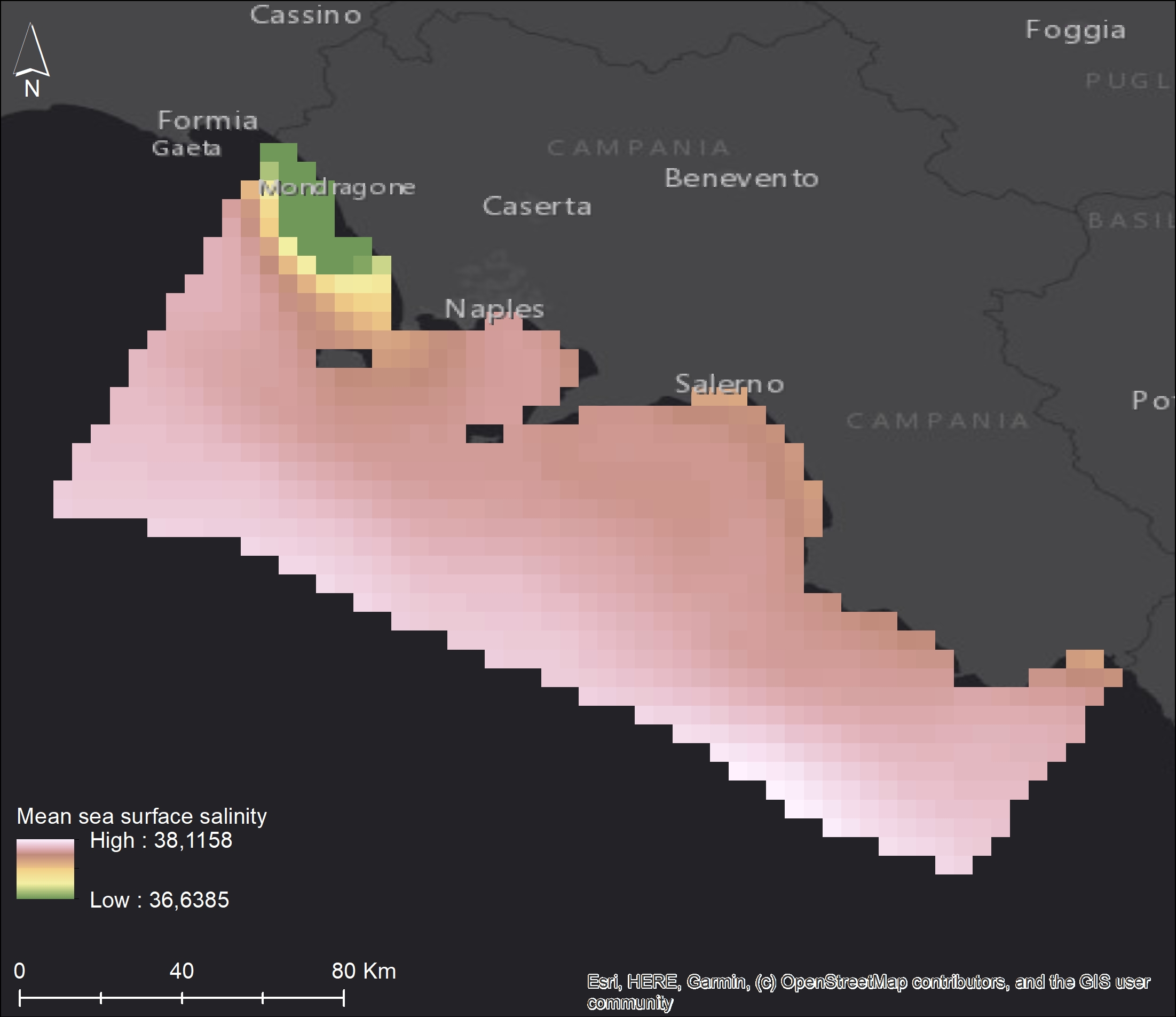
The superficial sea salinity (SSS) map package was built with daily-mean data remotely collected. The package contains mean SSS maps at 0.046 degrees (~5km) spatial resolution collected during 2020. The maps were also built over the four quarters of the year. These layers are provided with the suffixes Q1 to Q4.